Καλέστε μας
2310797405
2310797405
Προιόντα
Περιγραφή
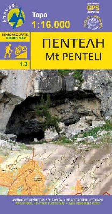
"The new hiking map of Mt Imitos in a scale of 1:10 000 covers the whole mountain. It is a combination of two maps in a folder: the map of the Northern Imitos covering the area of ??Agia Paraskevi to Ilioupoli and map of Southern Imitos extending between Ilioupoli, Argyroupoli, Glyfada, Voula and Koropi. Hiking and cycling routes are suggested and shown in detail. The mountain s points of interest such as caves, sinkholes and archaeological sites are pinpointed on the map."
Άλλες λεπτομέρειες
- Language:
- ΕΛΛΗΝΙΚΑ
- DateIssued:
- 2017-02-18
- Σελίδες:
- 1
- Διαστάσεις Προϊόντος (συσκευασμένο):
- 230Χ120Χ0
- Περιτύλιγμα Δώρου:
- Διαθέσιμες επιλογές στο καλάθι
- Βάρος:
- 250 g
ΣΧΕΤΙΚΑ ΠΡΟΪΟΝΤΑ
Είδατε πρόσφατα
-
ΤΕΧΝΟΛΟΓΙΑ & ΥΠΟΛΟΓΙΣΤΕΣ
- ΤΕΧΝΟΛΟΓΙΑ
- GAMING
- ΑΝΑΒΑΘΜΙΣΗ PC
-
ΠΕΡΙΦΕΡΕΙΑΚΑ ΚΑΙ ΔΙΚΤΥΑΚΑ
- ΠΕΡΙΦΕΡΕΙΑΚΑ ΚΑΙ ΔΙΚΤΥΑΚΑ
- CARD READERS
- ΔΙΚΤΥΑΚΑ
- ΚΑΛΩΔΙΑ ΔΙΚΤΥΟΥ
- EXTENDERS - REPEATERS - WIFI
- HOME MESH WIFI
- MOUSEPADS
- POWERLINES
- ROUTERS - MODEMS
- SWITCHES
- UPS
- USB HUBS
- WEB CAMERAS
- WIFI BLUETOOTH ADAPTERS
- ΒΑΣΕΙΣ PC/LAPTOP
- ΚΑΛΩΔΙΑ USB
- ΟΘΟΝΕΣ
- ΠΛΗΚΤΡΟΛΟΓΙΑ
- ΠΟΛΥΜΠΡΙΖΑ
- ΠΟΝΤΙΚΑ
- ΠΡΟΣΤΑΤΕΥΤΙΚΑ ΟΘΟΝΩΝ
- ΣΕΤ ΠΛΗΚΤΡΟΛΟΓΙΑ-ΠΟΝΤΙΚΙΑ
- ΤΣΑΝΤΕΣ ΜΕΤΑΦΟΡΑΣ LAPTOP
- ΑΠΟΘΗΚΕΥΣΗ
- ΗΧΟΣ ΚΑΙ ΕΙΚΟΝΑ
- ΕΚΤΥΠΩΣΗ
- ΦΟΡΤΙΣΤΕΣ & POWERBANKS
-
ΕΙΔΗ ΣΠΙΤΙΟΥ - ΓΡΑΦΕΙΟΥ & ΔΙΑΚΟΣΜΗΣΗΣ
- ΠΑΙΧΝΙΔΙΑ ΓΙΑ ΟΛΟΥΣ
-
ΕΛΛΗΝΙΚΗ ΛΟΓΟΤΕΧΝΙΑ ΜΗ ΛΟΓΟΤΕΧΝΙΚΑ, ΠΑΙΔΙΚΑ
- ΕΛΛΗΝΙΚΗ ΛΟΓΟΤΕΧΝΙΑ
- ΑΘΛΗΤΙΣΜΟΣ - ΧΟΜΠΥ
-
ΑΛΛΕΣ ΚΑΤΗΓΟΡΙΕΣ
- ΑΛΛΕΣ ΚΑΤΗΓΟΡΙΕΣ
- ΑΣΤΡΟΛΟΓΙΑ
- ΒΙΟΓΡΑΦΙΕΣ - ΠΡΟΣΩΠΙΚΕΣ ΜΑΡΤΥΡΙΕΣ
- ΒΥΖΑΝΤΙΝΗ ΙΣΤΟΡΙΑ
- ΓΝΩΣΗ
- ΓΥΜΝΑΣΤΙΚΗ
- ΔΟΚΙΜΙΑ - ΚΡΙΤΙΚΗ - ΜΕΛΕΤΕΣ
- ΕΚΠΑΙΔΕΥΣΗ - ΠΑΙΔΑΓΩΓΙΚΗ
- ΕΛΛΗΝΙΚΗ ΠΕΖΟΓΡΑΦΙΑ
- ΕΦΗΜΕΡΙΔΕΣ - ΠΕΡΙΟΔΙΚΑ
- ΗΜΕΡΟΛΟΓΙΑ - ΣΗΜΕΙΩΜΑΤΑΡΙΑ
- ΠΑΡΑΨΥΧΟΛΟΓΙΑ - ΠΑΡΑΦΥΣΙΚΑ ΦΑΙΝΟΜΕΝΑ
- ΠΕΡΙΒΑΛΛΟΝ - ΟΙΚΟΛΟΓΙΑ
- ΠΕΡΙΣΣΟΤΕΡΟΙ ΤΙΤΛΟΙ
- ΠΡΟΣΧΟΛΙΚΑ
- ΒΙΒΛΙΑ ΜΟΥΣΙΚΗΣ - ΜΟΥΣΙΚΑ ΟΡΓΑΝΑ
- ΙΣΤΟΡΙΑ - ΠΟΛΙΤΙΣΜΟΣ
- ΚΑΛΕΣ ΤΕΧΝΕΣ
- ΛΕΞΙΚΑ
- ΛΟΓΟΤΕΧΝΙΑ
- ΛΟΙΠΕΣ ΓΛΩΣΣΕΣ
-
ΟΙΚΟΝΟΜΙΑ, ΠΟΛΙΤΙΚΗ ΚΟΙΝΩΝΙΚΕΣ ΕΠΙΣΤΗΜΕΣ
- ΟΙΚΟΝΟΜΙΑ, ΠΟΛΙΤΙΚΗ ΚΟΙΝΩΝΙΚΕΣ ΕΠΙΣΤΗΜΕΣ
- ΑΝΑΤΟΛΙΚΗ ΦΙΛΟΣΟΦΙΑ - ΔΙΑΛΟΓΙΣΜΟΣ
- ΑΡΧΑΙΟΛΟΓΙΑ
- ΓΛΩΣΣΟΛΟΓΙΑ
- ΔΙΚΑΙΟ
- ΔΙΟΙΚΗΣΗ ΟΡΓΑΝΩΣΗ - ΜΑΡΚΕΤΙΝΓΚ
- ΔΟΚΙΜΙΑ - ΚΡΙΤΙΚΗ - ΜΕΛΕΤΕΣ
- ΕΚΠΑΙΔΕΥΣΗ - ΠΑΙΔΑΓΩΓΙΚΗ
- ΙΑΤΡΙΚΗ
- ΚΟΙΝΩΝΙΟΛΟΓΙΑ - ΑΝΘΡΩΠΟΛΟΓΙΑ
- ΛΑΟΓΡΑΦΙΑ - ΜΥΘΟΛΟΓΙΑ
- ΛΟΓΙΣΤΙΚΗ - ΦΟΡΟΛΟΓΙΑ
- ΟΙΚΟΝΟΜΙΑ
- ΠΕΡΙΒΑΛΛΟΝ - ΟΙΚΟΛΟΓΙΑ
- ΠΟΛΙΤΙΚΗ - ΠΟΛΙΤΙΚΕΣ ΕΠΙΣΤΗΜΕΣ
- ΤΕΧΝΟΛΟΓΙΑ - ΠΛΗΡΟΦΟΡΙΚΗ - ΤΗΛΕΠΙΚΟΙΝΩΝΙΕΣ
- ΦΙΛΟΣΟΦΙΑ - ΘΡΗΣΚΕΙΑ
- ΨΥΧΟΛΟΓΙΑ - ΨΥΧΑΝΑΛΥΣΗ
- ΟΠΤΙΚΟΑΚΟΥΣΤΙΚΑ ΜΕΣΑ
- ΠΑΙΔΙΚΑ - ΕΦΗΒΙΚΑ
-
ΣΠΙΤΙ, ΑΥΤΟΒΕΛΤΙΩΣΗ ΜΑΓΕΙΡΙΚΗ ΔΙΑΤΡΟΦΗ
- ΣΠΙΤΙ, ΑΥΤΟΒΕΛΤΙΩΣΗ ΜΑΓΕΙΡΙΚΗ ΔΙΑΤΡΟΦΗ
- ΑΥΤΟΒΕΛΤΙΩΣΗ - ΣΥΜΒΟΥΛΕΥΤΙΚΗ
- ΒΙΒΛΙΑ ΖΩΓΡΑΦΙΚΗΣ (ANTI STRESS)
- ΔΙΑΚΟΣΜΗΣΗ
- ΔΙΑΤΡΟΦΗ - ΔΙΑΙΤΑ
- ΕΓΚΥΜΟΣΥΝΗ - ΜΗΤΡΟΤΗΤΑ - ΑΝΑΤΡΟΦΗ ΠΑΙΔΙΩΝ
- ΚΑΤΟΙΚΙΔΙΑ ΖΩΑ
- ΜΑΓΕΙΡΙΚΗ - ΚΡΑΣΙΑ - ΠΟΤΑ
- ΠΑΙΔΙΚΑ ΛΕΥΚΩΜΑΤΑ ΕΓΚΥΜΟΣΥΝΗΣ
- ΦΡΟΝΤΙΔΑ - ΥΓΙΕΙΝΗ - ΟΜΟΡΦΙΑ
- ΧΕΙΡΟΤΕΧΝΙΑ - ΚΑΤΑΣΚΕΥΕΣ
- ΨΥΧΟΛΟΓΙΑ - ΨΥΧΑΝΑΛΥΣΗ
- ΤΑΞΙΔΙΩΤΙΚΟΙ ΟΔΗΓΟΙ - ΧΑΡΤΕΣ
- ΦΥΣΙΚΕΣ, ΘΕΤΙΚΕΣ ΕΦΑΡΜΟΣΜΕΝΕΣ ΕΠΙΣΤΗΜΕΣ
-
ΕΛΛΗΝΙΚΑ ΕΚΠΑΙΔΕΥΤΙΚΑ
-
ΞΕΝΟΓΛΩΣΣΑ ΕΚΠΑΙΔΕΥΤΙΚΑ
- ΞΕΝΟΓΛΩΣΣΑ
- ΑΓΓΛΙΚΑ
- ΑΙΓΥΠΤΙΑΚΑ
- ΑΛΒΑΝΙΚΑ
- ΑΡΑΒΙΚΑ
- ΒΟΥΛΓΑΡΙΚΑ
- ΓΑΛΛΙΚΑ
- ΓΕΡΜΑΝΙΚΑ
- ΓΕΩΡΓΙΑΝΑ
- ΔΑΝΕΖΙΚΑ
- ΕΒΡΑΙΚΑ
- ΕΚΠΑΙΔΕΥΤΙΚΑ ΒΙΒΛΙΑ
- ΕΛΛΗΝΙΚΑ
- ΙΑΠΩΝΙΚΑ
- ΙΝΔΙΚΑ
- ΙΣΠΑΝΙΚΑ
- ΙΤΑΛΙΚΑ
- ΚΙΝΕΖΙΚΑ
- ΚΟΡΕΑΤΙΚΑ
- ΚΟΥΡΔΙΚΑ
- ΚΡΟΑΤΙΚΑ
- ΛΑΤΙΝΙΚΑ
- ΛΕΞΙΚΑ
- ΝΟΡΒΗΓΙΚΑ
- ΟΛΛΑΝΔΙΚΑ
- ΟΥΓΓΡΙΚΑ
- ΟΥΡΝΤΟΥ (ΙΝΔΙΚΑ)
- ΠΟΛΩΝΙΚΑ
- ΠΟΡΤΟΓΑΛΙΚΑ
- ΡΟΥΜΑΝΙΚΑ
- ΡΩΣΙΚΑ
- ΣΕΡΒΙΚΑ
- ΣΛΟΒΑΚΙΚΑ
- ΣΟΥΗΔΙΚΑ
- ΤΟΥΡΚΙΚΑ
- ΤΣΕΧΙΚΑ
-
ΞΕΝΟΓΛΩΣΣΗ ΛΟΓΟΤΕΧΝΙΑ ΜΗ ΛΟΓΟΤΕΧΝΙΚΑ, ΠΑΙΔΙΚΑ
- ΞΕΝΟΓΛΩΣΣΗ ΛΟΓΟΤΕΧΝΙΑ
- ΙΣΤΟΡΙΑ - ΠΟΛΙΤΙΣΜΟΣ
- ΚΑΛΕΣ ΤΕΧΝΕΣ
- ΛΟΓΟΤΕΧΝΙΑ
- ΟΙΚΟΝΟΜΙΑ, ΠΟΛΙΤΙΚΗ ΚΟΙΝΩΝΙΚΕΣ ΕΠΙΣΤΗΜΕΣ
- ΠΑΙΔΙΚΑ - ΕΦΗΒΙΚΑ
- ΠΕΡΙΟΔΙΚΑ - ΣΗΜΕΙΩΜΑΤΑΡΙΑ - ΗΜΕΡΟΛΟΓΙΑ
- ΣΠΙΤΙ, ΑΥΤΟΒΕΛΤΙΩΣΗ ΜΑΓΕΙΡΙΚΗ ΔΙΑΤΡΟΦΗ
- ΤΑΞΙΔΙΩΤΙΚΟΙ ΟΔΗΓΟΙ - ΧΑΡΤΕΣ
- ΦΥΣΙΚΕΣ, ΘΕΤΙΚΕΣ ΕΦΑΡΜΟΣΜΕΝΕΣ ΕΠΙΣΤΗΜΕΣ
- ΑΘΛΗΤΙΣΜΟΣ - ΧΟΜΠΥ
- ΆΛΛΕΣ ΚΑΤΗΓΟΡΙΕΣ


